
Orwell topographic map
Interactive map
Click on the map to display elevation.
About this map
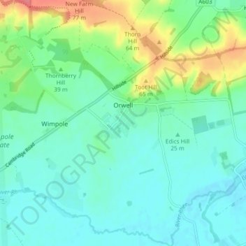
Name: Orwell topographic map, elevation, terrain.
Average elevation: 112 ft
Minimum elevation: 49 ft
Maximum elevation: 289 ft
Other topographic maps
Click on a map to view its topography, its elevation and its terrain.
Waterbeach
United Kingdom > England > Cambridgeshire > South Cambridgeshire
Waterbeach, South Cambridgeshire, Cambridgeshire, Cambridgeshire and Peterborough, England, United Kingdom
Average elevation: 13 ft