
La Encarnación topographic map
Interactive map
Click on the map to display elevation.
About this map
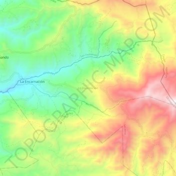
Name: La Encarnación topographic map, elevation, terrain.
Location: La Encarnación, Ocotepeque, Honduras (14.63342 -89.10391 14.69298 -88.98987)
Average elevation: 4,718 ft
Minimum elevation: 2,618 ft
Maximum elevation: 7,598 ft
Other topographic maps
Click on a map to view its topography, its elevation and its terrain.