
Timhadit topographic map
Interactive map
Click on the map to display elevation.
About this map
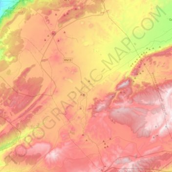
Name: Timhadit topographic map, elevation, terrain.
Average elevation: 6,240 ft
Minimum elevation: 3,714 ft
Maximum elevation: 8,012 ft
Timahdite (en tamazight ⵜⵉⵎⴰⵃⴹⵉⵜ, en arabe. تمحضيت) est une ville du Maroc. Elle est située dans la région de Fès-Meknès, à 1 800 m d'altitude, en plein cœur du Moyen Atlas, dans une zone au climat rude.
Other topographic maps
Click on a map to view its topography, its elevation and its terrain.