
Kirby Muxloe topographic map
Interactive map
Click on the map to display elevation.
About this map
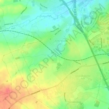
Name: Kirby Muxloe topographic map, elevation, terrain.
Location: Kirby Muxloe, Blaby, Leicestershire, England, United Kingdom (52.61118 -1.26505 52.64624 -1.20541)
Average elevation: 318 ft
Minimum elevation: 236 ft
Maximum elevation: 420 ft