
Iserlohn topographic map
Interactive map
Click on the map to display elevation.
About this map
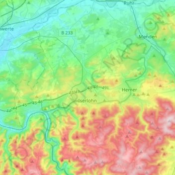
Name: Iserlohn topographic map, elevation, terrain.
Location: Iserlohn, Märkischer Kreis, North Rhine-Westphalia, Germany (51.30176 7.58412 51.47365 7.74499)
Average elevation: 823 ft
Minimum elevation: 338 ft
Maximum elevation: 1,788 ft