
Pearl District topographic map
Interactive map
Click on the map to display elevation.
About this map
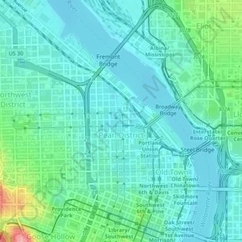
Name: Pearl District topographic map, elevation, terrain.
Location: Pearl District, Portland, Multnomah County, Oregon, USA (45.52289 -122.68706 45.53825 -122.67430)
Average elevation: 82 ft
Minimum elevation: 7 ft
Maximum elevation: 394 ft
Other topographic maps
Click on a map to view its topography, its elevation and its terrain.
Mount Tabor
Mount Tabor, Portland, Multnomah County, Oregon, 97215, USA
Average elevation: 282 ft
Hosford-Abernethy
Hosford-Abernethy, Portland, Multnomah County, Oregon, USA
Average elevation: 85 ft