
Col de Peyresourde topographic map
Interactive map
Click on the map to display elevation.
About this map
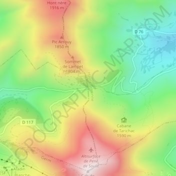
Name: Col de Peyresourde topographic map, elevation, terrain.
Average elevation: 5,299 ft
Minimum elevation: 4,196 ft
Maximum elevation: 6,621 ft
Other topographic maps
Click on a map to view its topography, its elevation and its terrain.
Loudervielle
France > Occitania > Loudervielle
Loudervielle, Bagnères-de-Bigorre, Hautespyrenees, Occitania, Metropolitan France, France
Average elevation: 4,081 ft