
Thank you for supporting this site ❤️
Make a donation
Make a donation
Gear up for your next adventure:
As an Amazon Associate, this site earns from qualifying purchases at no extra cost to you.
Oberrüti topographic map
Click on the map to display elevation.
Thank you for supporting this site ❤️
Make a donation
Make a donation
Gear up for your next adventure:
As an Amazon Associate, this site earns from qualifying purchases at no extra cost to you.
About this map
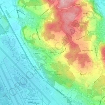
Name: Oberrüti topographic map, elevation, terrain.
Location: Oberrüti, Winkel, Bezirk Bülach, Zurich, 8185, Switzerland (47.46033 8.54562 47.50033 8.58562)
Average elevation: 1,578 ft
Minimum elevation: 1,362 ft
Maximum elevation: 1,952 ft
Thank you for supporting this site ❤️
Make a donation
Make a donation
Gear up for your next adventure:
As an Amazon Associate, this site earns from qualifying purchases at no extra cost to you.