Geolocate

Raigad Fort topographic map

Click on the map to display elevation.

About this map
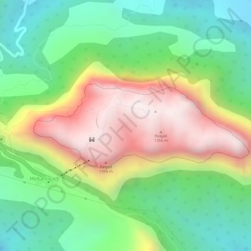
Name: Raigad Fort topographic map, elevation, terrain.

Location: Raigad Fort, Raigad Fort Trail, Hirkaniwadi, Mahad Taluka, Raigad, Maharashtra, 402104, India (18.23072 73.43435 18.23979 73.45876)

Average elevation: 1,476 ft

Minimum elevation: 423 ft

Maximum elevation: 2,841 ft

Other topographic maps

Click on a map to view its topography, its elevation and its terrain.

Raigad

India > Maharashtra > Mahad Taluka > Hirkaniwadi

Average elevation: 1,444 ft

Gear up for your next adventure:

🎒Day Hiking Backpack - Lightweight backpack perfect for day trips and outdoor adventures
🌡️Handheld Weather Meters - Measure wind, temp, and pressure for safe mountain travel
🩹Survival Bandages - High‑quality bandages for emergencies
⌚Solar GPS Watches - Advanced multisport watches with built-in topographic maps
🦺Reflective Outdoor Gear - Safety gear for low‑light conditions

As an Amazon Associate, this site earns from qualifying purchases at no extra cost to you.