
Louth Island topographic map
Interactive map
Click on the map to display elevation.
About this map
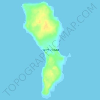
Name: Louth Island topographic map, elevation, terrain.
Location: Louth Island, Port Lincoln, South Australia, Australia (-34.59400 135.94534 -34.56779 135.96166)
Average elevation: 10 ft
Minimum elevation: -3 ft
Maximum elevation: 79 ft
Other topographic maps
Click on a map to view its topography, its elevation and its terrain.
Bicker Isles
Australia > South Australia > Port Lincoln
Bicker Isles, Port Lincoln, South Australia, Australia
Average elevation: 102 ft