
Guttau topographic map
Interactive map
Click on the map to display elevation.
About this map
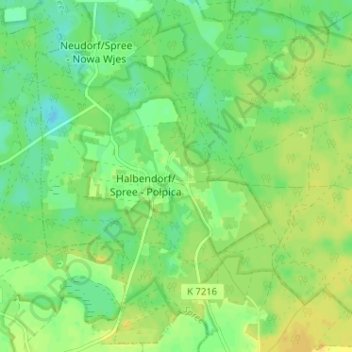
Name: Guttau topographic map, elevation, terrain.
Location: Guttau, Geißlitz, Bautzen, Sachsen, 02694, Deutschland (51.27939 14.54026 51.31939 14.58026)
Average elevation: 469 ft
Minimum elevation: 433 ft
Maximum elevation: 499 ft