
Zell topographic map
Interactive map
Click on the map to display elevation.
About this map
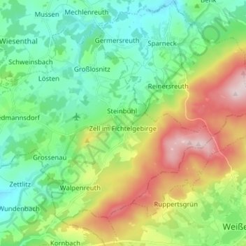
Name: Zell topographic map, elevation, terrain.
Location: Zell, Landkreis Hof, Beieren, 95239, Duitsland (50.10336 11.74045 50.16755 11.86622)
Average elevation: 2,064 ft
Minimum elevation: 1,716 ft
Maximum elevation: 2,789 ft