
Osborn topographic map
Interactive map
Click on the map to display elevation.
About this map
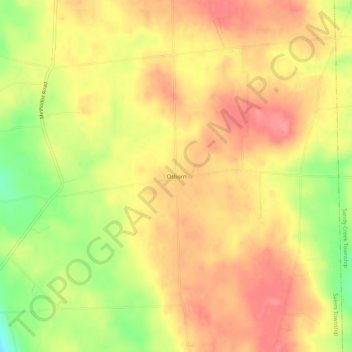
Name: Osborn topographic map, elevation, terrain.
Location: Osborn, Mercer County, Pennsylvania, USA (41.44200 -80.30895 41.48200 -80.26895)
Average elevation: 1,329 ft
Minimum elevation: 1,161 ft
Maximum elevation: 1,427 ft