
Courtedoux topographic map
Interactive map
Click on the map to display elevation.
About this map
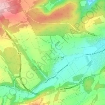
Name: Courtedoux topographic map, elevation, terrain.
Location: Courtedoux, District de Porrentruy, Jura, 2905, Suisse (47.39480 7.00049 47.43075 7.05728)
Average elevation: 1,654 ft
Minimum elevation: 1,348 ft
Maximum elevation: 2,080 ft