
Le Chaudron topographic map
Interactive map
Click on the map to display elevation.
About this map
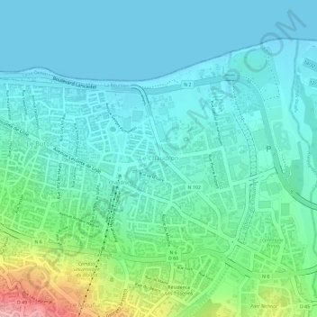
Name: Le Chaudron topographic map, elevation, terrain.
Location: Le Chaudron, Saint-Denis, La Réunion, France (-20.90151 55.47984 -20.88355 55.49931)
Average elevation: 118 ft
Minimum elevation: 0 ft
Maximum elevation: 512 ft
Other topographic maps
Click on a map to view its topography, its elevation and its terrain.
Bellepierre
France > La Réunion > Saint-Denis
Bellepierre, Saint-Denis, La Réunion, France
Average elevation: 1,060 ft
Montgaillard
France > La Réunion > Saint-Denis
Montgaillard, Saint-Denis, La Réunion, France
Average elevation: 640 ft