
Olhain topographic map
Interactive map
Click on the map to display elevation.
About this map
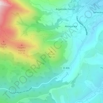
Name: Olhain topographic map, elevation, terrain.
Average elevation: 741 ft
Minimum elevation: 200 ft
Maximum elevation: 2,297 ft
Other topographic maps
Click on a map to view its topography, its elevation and its terrain.
Olhain
France > Nouvelle-Aquitaine > Pyrénées-Atlantiques > Sare
Olhain, Sare, Bayonne, Pyrénées-Atlantiques, Nouvelle-Aquitaine, France métropolitaine, 64310, France
Average elevation: 741 ft