
Los Cerrillos topographic map
Interactive map
Click on the map to display elevation.
About this map
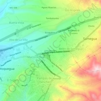
Name: Los Cerrillos topographic map, elevation, terrain.
Location: Los Cerrillos, Mariscal Nieto, Moquegua, Peru (-17.20663 -70.93625 -17.16663 -70.89625)
Average elevation: 5,007 ft
Minimum elevation: 4,528 ft
Maximum elevation: 5,817 ft