
هاشمية topographic map
Interactive map
Click on the map to display elevation.
About this map
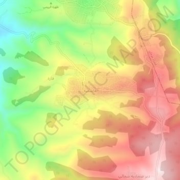
Name: هاشمية topographic map, elevation, terrain.
Average elevation: 1,686 ft
Minimum elevation: 663 ft
Maximum elevation: 2,559 ft
Other topographic maps
Click on a map to view its topography, its elevation and its terrain.
Ajloun
Jordan > Ajlun > Ajloun Sub-District
Ajloun, Ajloun Sub-District, Ajloun Qasabah District, Ajlun, Jordan
Average elevation: 2,864 ft
Anjara
Jordan > Ajlun > Ajloun Sub-District
Anjara, Ajloun Sub-District, Ajloun Qasabah District, Ajlun, Jordan
Average elevation: 3,153 ft