
雷家河沟塆 topographic map
Interactive map
Click on the map to display elevation.
About this map
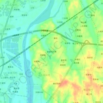
Name: 雷家河沟塆 topographic map, elevation, terrain.
Location: 雷家河沟塆, 鼓楼, 麻城市, 黄冈市, 湖北省, 中国 (31.19091 115.03092 31.23091 115.07092)
Average elevation: 217 ft
Minimum elevation: 157 ft
Maximum elevation: 308 ft