
Saint-Benoît topographic map
Interactive map
Click on the map to display elevation.
About this map
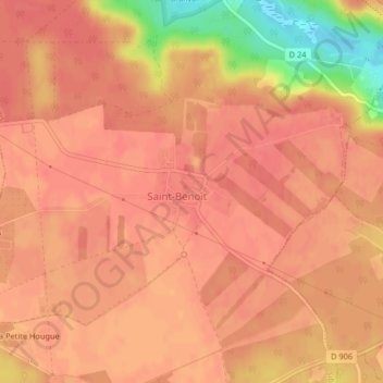
Name: Saint-Benoît topographic map, elevation, terrain.
Average elevation: 551 ft
Minimum elevation: 400 ft
Maximum elevation: 587 ft
Other topographic maps
Click on a map to view its topography, its elevation and its terrain.
Réserve biologique dirigée du Pont Granval
France > Île-de-France > Yvelines > Saint-Benoît
Réserve biologique dirigée du Pont Granval, D 24, Saint-Benoît, Auffargis, Rambouillet, Yvelines, Île-de-France, France métropolitaine, 78610, France
Average elevation: 531 ft