
La Grulla topographic map
Interactive map
Click on the map to display elevation.
About this map
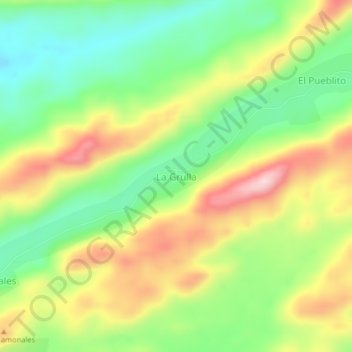
Name: La Grulla topographic map, elevation, terrain.
Location: La Grulla, Distrito Caroní, Bolivar State, Venezuela (8.18560 -62.39094 8.22560 -62.35094)
Average elevation: 1,056 ft
Minimum elevation: 686 ft
Maximum elevation: 1,542 ft