
Gunung Gede topographic map
Interactive map
Click on the map to display elevation.
About this map
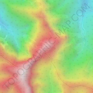
Name: Gunung Gede topographic map, elevation, terrain.
Location: Gunung Gede, Jombang, East Java, Java, Indonesia (-7.76535 112.43655 -7.76525 112.43665)
Average elevation: 5,469 ft
Minimum elevation: 3,917 ft
Maximum elevation: 7,080 ft
Other topographic maps
Click on a map to view its topography, its elevation and its terrain.
Tunggorono
Indonesia > East Java > Jombang
Tunggorono, Jombang, East Java, Java, 61416, Indonesia
Average elevation: 144 ft