
Kikori River topographic map
Interactive map
Click on the map to display elevation.
About this map
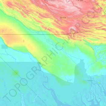
Name: Kikori River topographic map, elevation, terrain.
Location: Kikori River, Gulf, Papua Region, Papua New Guinea (-7.73630 142.93227 -6.38149 144.29491)
Average elevation: 1,368 ft
Minimum elevation: -10 ft
Maximum elevation: 7,234 ft
Other topographic maps
Click on a map to view its topography, its elevation and its terrain.
Kikori
Kikori, Gulf, Southern Region, Papua New Guinea
Average elevation: 26 ft
Gulf of Papua
Gulf of Papua, Kerema District, Gulf, Papua Region, Papua New Guinea
Average elevation: 1,293 ft