Geolocate

Vail topographic map

Click on the map to display elevation.

About this map

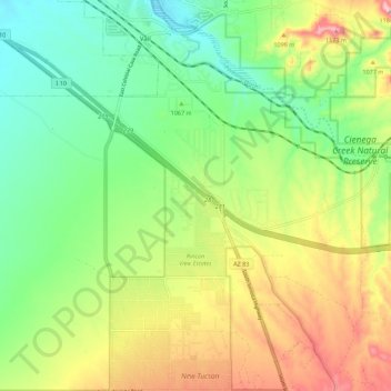
Name: Vail topographic map, elevation, terrain.

Location: Vail, Pima County, Arizona, United States (31.96314 -110.72319 32.05694 -110.63730)

Average elevation: 3,396 ft

Minimum elevation: 3,100 ft

Maximum elevation: 3,858 ft

Pima County trails, hiking, mountain biking, running and outdoor activities

Gear up for your next adventure:

🥾Men's Hiking Boots - Durable, waterproof footwear for rugged terrain and steep inclines
🛡️Insect Repellent - Protection against bugs during outdoor activities
🏕️Tent Footprint - Protect your tent base from wear
😴Insulated Sleeping Pads - Compact and warm pads for high-elevation camping
🛡️Bear Spray Outdoor - Protection in bear country hikes

As an Amazon Associate, this site earns from qualifying purchases at no extra cost to you.