
Kaga-Bandoro topographic map
Interactive map
Click on the map to display elevation.
About this map
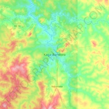
Name: Kaga-Bandoro topographic map, elevation, terrain.
Location: Kaga-Bandoro, Nana-Grébizi, Central African Republic (6.83931 19.02231 7.15931 19.34231)
Average elevation: 1,486 ft
Minimum elevation: 1,319 ft
Maximum elevation: 1,818 ft