
La Libertad topographic map
Interactive map
Click on the map to display elevation.
About this map
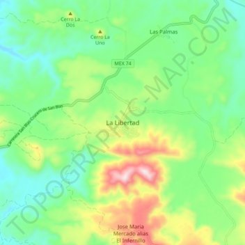
Name: La Libertad topographic map, elevation, terrain.
Location: La Libertad, San Blas, Nayarit, 63765, México (21.55408 -105.21291 21.63408 -105.13291)
Average elevation: 528 ft
Minimum elevation: 49 ft
Maximum elevation: 1,522 ft