
Jallel topographic map
Interactive map
Click on the map to display elevation.
About this map
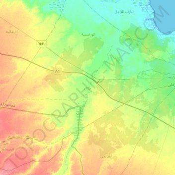
Name: Jallel topographic map, elevation, terrain.
Location: Jallel, Ben Guerdane, Médenine, Tunisie (33.05918 10.89762 33.18626 11.20791)
Average elevation: 98 ft
Minimum elevation: -13 ft
Maximum elevation: 230 ft
Other topographic maps
Click on a map to view its topography, its elevation and its terrain.
El Jouamaa
El Jouamaa, Djerba Houmet Souk, Médenine, Tunisie
Average elevation: 33 ft
Parc National Sidi Toui
Parc National Sidi Toui, El Amria, Ben Guerdane, Médenine, Tunisie
Average elevation: 341 ft