
La Carlota topographic map
Interactive map
Click on the map to display elevation.
About this map
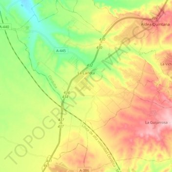
Name: La Carlota topographic map, elevation, terrain.
Location: La Carlota, Cordova, Andalusia, Spain (37.59974 -5.01603 37.72972 -4.86323)
Average elevation: 699 ft
Minimum elevation: 384 ft
Maximum elevation: 1,066 ft