
Sonaguera topographic map
Interactive map
Click on the map to display elevation.
About this map
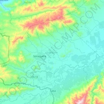
Name: Sonaguera topographic map, elevation, terrain.
Location: Sonaguera, Colón, Honduras (15.53127 -86.40753 15.72882 -86.09745)
Average elevation: 784 ft
Minimum elevation: 7 ft
Maximum elevation: 4,173 ft
Other topographic maps
Click on a map to view its topography, its elevation and its terrain.