
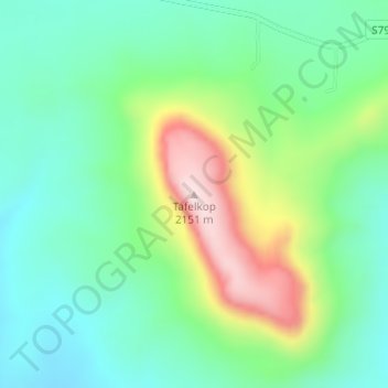
Tafelkop topographic map
Interactive map
Click on the map to display elevation.
About this map
Name: Tafelkop topographic map, elevation, terrain.
Average elevation: 6,198 ft
Minimum elevation: 5,804 ft
Maximum elevation: 7,060 ft
Other topographic maps
Click on a map to view its topography, its elevation and its terrain.
Kliprivier
South Africa > Free State > Phumelela Local Municipality
Kliprivier, Phumelela Local Municipality, Thabo Mofutsanyana District Municipality, Free State, South Africa
Average elevation: 5,958 ft