
Thank you for supporting this site ❤️
Make a donation
Make a donation
Gear up for your next adventure:
As an Amazon Associate, this site earns from qualifying purchases at no extra cost to you.
Ypres topographic map
Click on the map to display elevation.
Thank you for supporting this site ❤️
Make a donation
Make a donation
Gear up for your next adventure:
As an Amazon Associate, this site earns from qualifying purchases at no extra cost to you.
About this map
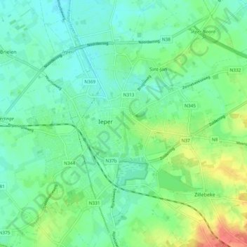
Name: Ypres topographic map, elevation, terrain.
Location: Ypres, Ieper, West Flanders, Flanders, 8900, Belgium (50.82831 2.85835 50.87493 2.95238)
Average elevation: 79 ft
Minimum elevation: 30 ft
Maximum elevation: 197 ft
Thank you for supporting this site ❤️
Make a donation
Make a donation
Gear up for your next adventure:
As an Amazon Associate, this site earns from qualifying purchases at no extra cost to you.