
Guadalajara topographic map
Interactive map
Click on the map to display elevation.
About this map
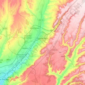
Name: Guadalajara topographic map, elevation, terrain.
Location: Guadalajara, Castilië-La Mancha, Spanje (40.46083 -3.31415 40.77072 -2.98119)
Average elevation: 2,631 ft
Minimum elevation: 1,916 ft
Maximum elevation: 3,294 ft