
Barranca topographic map
Interactive map
Click on the map to display elevation.
About this map
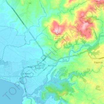
Name: Barranca topographic map, elevation, terrain.
Average elevation: 328 ft
Minimum elevation: -3 ft
Maximum elevation: 1,368 ft
Other topographic maps
Click on a map to view its topography, its elevation and its terrain.
San Miguel
Costa Rica > Provincia Puntarenas > Barranca > San Miguel
San Miguel, Barranca, Cantón Puntarenas, Provincia Puntarenas, 60108, Costa Rica
Average elevation: 630 ft