
Thank you for supporting this site ❤️
Make a donation
Make a donation
Gear up for your next adventure:
As an Amazon Associate, this site earns from qualifying purchases at no extra cost to you.
Ludwigsfelde topographic map
Click on the map to display elevation.
Thank you for supporting this site ❤️
Make a donation
Make a donation
Gear up for your next adventure:
As an Amazon Associate, this site earns from qualifying purchases at no extra cost to you.
About this map
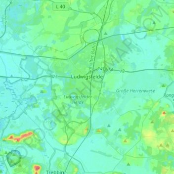
Name: Ludwigsfelde topographic map, elevation, terrain.
Location: Ludwigsfelde, Teltow-Fläming, Brandenburg, 14974, Germany (52.24490 13.13752 52.33890 13.39374)
Average elevation: 138 ft
Minimum elevation: 105 ft
Maximum elevation: 322 ft
Thank you for supporting this site ❤️
Make a donation
Make a donation
Gear up for your next adventure:
As an Amazon Associate, this site earns from qualifying purchases at no extra cost to you.