
San Jacinto topographic map
Interactive map
Click on the map to display elevation.
About this map
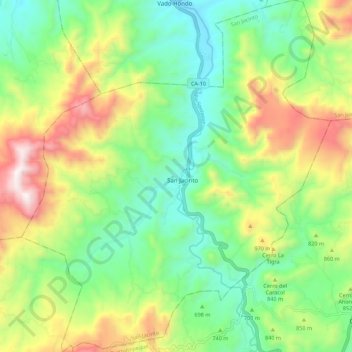
Name: San Jacinto topographic map, elevation, terrain.
Location: San Jacinto, Chiquimula, Guatemala (14.62498 -89.55314 14.73172 -89.45620)
Average elevation: 2,562 ft
Minimum elevation: 1,371 ft
Maximum elevation: 4,665 ft
Other topographic maps
Click on a map to view its topography, its elevation and its terrain.
Sabana Grande
Guatemala > Chiquimula > Chiquimula > Sabana Grande
Sabana Grande, Chiquimula, Guatemala
Average elevation: 1,752 ft