
Thank you for supporting this site ❤️
Make a donation
Make a donation
Gear up for your next adventure:
As an Amazon Associate, this site earns from qualifying purchases at no extra cost to you.
Infiernillo topographic map
Click on the map to display elevation.
Thank you for supporting this site ❤️
Make a donation
Make a donation
Gear up for your next adventure:
As an Amazon Associate, this site earns from qualifying purchases at no extra cost to you.
About this map
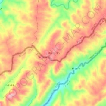
Name: Infiernillo topographic map, elevation, terrain.
Location: Infiernillo, Paletillas, Zapotillo, Loja, Ecuador (-4.23131 -80.35196 -4.19131 -80.31196)
Average elevation: 1,680 ft
Minimum elevation: 1,296 ft
Maximum elevation: 1,936 ft
Thank you for supporting this site ❤️
Make a donation
Make a donation
Gear up for your next adventure:
As an Amazon Associate, this site earns from qualifying purchases at no extra cost to you.