Geolocate

Fitzcarrald topographic map

Click on the map to display elevation.

About this map
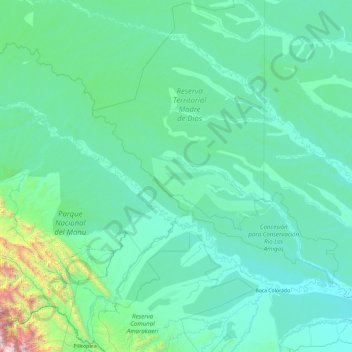
Name: Fitzcarrald topographic map, elevation, terrain.

Location: Fitzcarrald, Province of Manú, Madre de Dios, Peru (-12.71800 -72.42874 -11.31510 -70.53616)

Average elevation: 1,490 ft

Minimum elevation: 679 ft

Maximum elevation: 12,805 ft

Gear up for your next adventure:

🧭Compass with Lanyard - Easy‑carry compass for navigation
❄️Traction Cleats - Prevent slips on icy trails during winter hikes
🚗GPS Dash Cams - Record your scenic drives through mountain passes and canyons
🧼Biodegradable Camping Soap - Eco‑friendly soap for outdoor hygiene
🛰️Handheld GPS Units - Professional satellite navigators for precise backcountry mapping

As an Amazon Associate, this site earns from qualifying purchases at no extra cost to you.