
Lamadrid topographic map
Interactive map
Click on the map to display elevation.
About this map
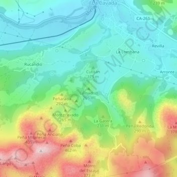
Name: Lamadrid topographic map, elevation, terrain.
Location: Lamadrid, Riotuerto, Trasmiera, Cantabria, 39720, España (43.33876 -3.70863 43.33886 -3.70853)
Average elevation: 594 ft
Minimum elevation: 171 ft
Maximum elevation: 1,444 ft