
Make a donation
Gear up for your next adventure:
As an Amazon Associate, this site earns from qualifying purchases at no extra cost to you.
Arnett topographic map
Click on the map to display elevation.
Make a donation
Gear up for your next adventure:
As an Amazon Associate, this site earns from qualifying purchases at no extra cost to you.
Arnett
Arnett is located at 36°8′4″N 99°46′15″W / 36.13444°N 99.77083°W / 36.13444; -99.77083 (36.134368, −99.770826) at an elevation of 2,447 feet (746 m). It lies approximately 9 miles (14 km) north-northeast of the Canadian River in the rolling Red Plains region of the Great Plains. Located in northwestern Oklahoma at the junction of U.S. Route 60 and U.S. Route 283, Arnett is 131 mi (211 km) west-northwest of Oklahoma City, 135 mi (217 km) northeast of Amarillo, and 172 mi (277 km) southwest of Wichita.
Make a donation
Gear up for your next adventure:
As an Amazon Associate, this site earns from qualifying purchases at no extra cost to you.
About this map
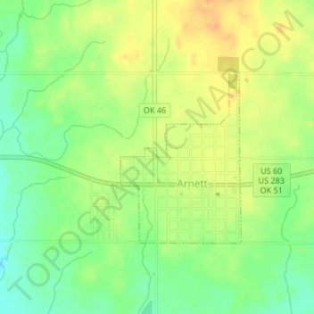
Name: Arnett topographic map, elevation, terrain.
Location: Arnett, Ellis County, Oklahoma, 73832, United States (36.12998 -99.77861 36.14447 -99.76481)
Average elevation: 2,451 ft
Minimum elevation: 2,388 ft
Maximum elevation: 2,507 ft
Ellis County trails, hiking, mountain biking, running and outdoor activities
Make a donation
Gear up for your next adventure:
As an Amazon Associate, this site earns from qualifying purchases at no extra cost to you.