
Randolphville topographic map
Click on the map to display elevation.
About this map
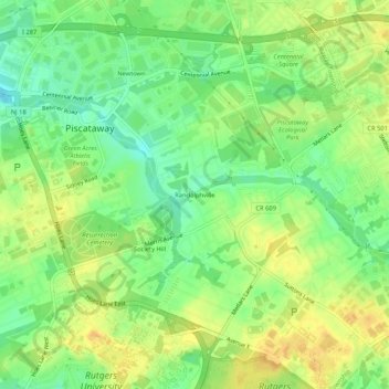
Name: Randolphville topographic map, elevation, terrain.
Average elevation: 85 ft
Minimum elevation: 33 ft
Maximum elevation: 128 ft
Middlesex County trails, hiking, mountain biking, running and outdoor activities
Other topographic maps
Click on a map to view its topography, its elevation and its terrain.
Rutgers University-Livingston Campus
United States > New Jersey > Middlesex County > Piscataway Township
Average elevation: 82 ft