Geolocate

Meijiang District topographic map

Click on the map to display elevation.

About this map
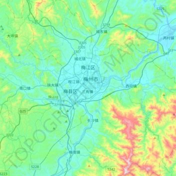
Name: Meijiang District topographic map, elevation, terrain.

Location: Meijiang District, Meizhou, Guangdong, China (24.11287 115.98984 24.43570 116.33769)

Average elevation: 794 ft

Minimum elevation: 194 ft

Maximum elevation: 3,261 ft

Gear up for your next adventure:

☀️Outdoor Sunscreen - High protection sunscreen for outdoor activities
🔪Outdoor Multitools - Essential survival tools for gear repair and field use
🥾Women's Hiking Boots - Top-rated trail boots with ankle support and superior grip
🖼️Topo Map Wall Art - Decorative topographic prints of famous peaks and regions
🧭Compass with Lanyard - Easy‑carry compass for navigation

As an Amazon Associate, this site earns from qualifying purchases at no extra cost to you.