
Arrs Mountain topographic map
Interactive map
Click on the map to display elevation.
About this map
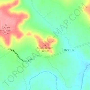
Name: Arrs Mountain topographic map, elevation, terrain.
Location: Arrs Mountain, Bosque County, Texas, États-Unis d'Amérique (31.81788 -97.66313 31.81798 -97.66303)
Average elevation: 807 ft
Minimum elevation: 692 ft
Maximum elevation: 1,024 ft