
Pomocne topographic map
Interactive map
Click on the map to display elevation.
About this map
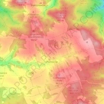
Name: Pomocne topographic map, elevation, terrain.
Average elevation: 1,289 ft
Minimum elevation: 909 ft
Maximum elevation: 1,490 ft
Other topographic maps
Click on a map to view its topography, its elevation and its terrain.
Muchów
Poland > Lower Silesian Voivodeship > Jawor County
Muchów, gmina Męcinka, Jawor County, Lower Silesian Voivodeship, Poland
Average elevation: 1,260 ft
Langeberg
Poland > Lower Silesian Voivodeship > Jawor County > Jastrowiec
Langeberg, Jastrowiec, gmina Bolków, Jawor County, Lower Silesian Voivodeship, 59-420, Poland
Average elevation: 1,270 ft
Bolków
Poland > Lower Silesian Voivodeship > Jawor County
Bolków, gmina Bolków, Jawor County, Lower Silesian Voivodeship, 59-420, Poland
Average elevation: 1,155 ft