
Thank you for supporting this site ❤️
Make a donation
Make a donation
Gear up for your next adventure:
As an Amazon Associate, this site earns from qualifying purchases at no extra cost to you.
Yamate topographic map
Click on the map to display elevation.
Thank you for supporting this site ❤️
Make a donation
Make a donation
Gear up for your next adventure:
As an Amazon Associate, this site earns from qualifying purchases at no extra cost to you.
About this map
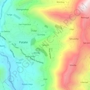
Name: Yamate topographic map, elevation, terrain.
Location: Yamate, Patate, Tungurahua, 180550, Ecuador (-1.33340 -78.51707 -1.29340 -78.47707)
Average elevation: 8,025 ft
Minimum elevation: 6,594 ft
Maximum elevation: 10,240 ft
Thank you for supporting this site ❤️
Make a donation
Make a donation
Gear up for your next adventure:
As an Amazon Associate, this site earns from qualifying purchases at no extra cost to you.