
大理苍山石门关旅游度假区 topographic map
Interactive map
Click on the map to display elevation.
About this map
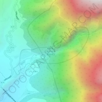
Name: 大理苍山石门关旅游度假区 topographic map, elevation, terrain.
Location: 大理苍山石门关旅游度假区, 光明生态园线, 白乙地, 金牛村, 漾濞彝族自治县, 大理白族自治州, 云南省, 中国 (25.63677 100.02637 25.64952 100.04868)
Average elevation: 6,693 ft
Minimum elevation: 5,049 ft
Maximum elevation: 9,501 ft