
Thank you for supporting this site ❤️
Make a donation
Make a donation
Gear up for your next adventure:
As an Amazon Associate, this site earns from qualifying purchases at no extra cost to you.
Illingen topographic map
Click on the map to display elevation.
Thank you for supporting this site ❤️
Make a donation
Make a donation
Gear up for your next adventure:
As an Amazon Associate, this site earns from qualifying purchases at no extra cost to you.
About this map
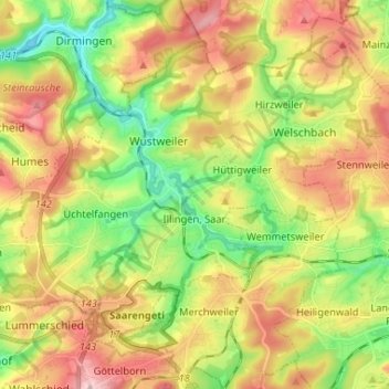
Name: Illingen topographic map, elevation, terrain.
Location: Illingen, Landkreis Neunkirchen, Saarland, 66557, Germany (49.34948 6.99397 49.41648 7.12419)
Average elevation: 1,086 ft
Minimum elevation: 774 ft
Maximum elevation: 1,447 ft
Thank you for supporting this site ❤️
Make a donation
Make a donation
Gear up for your next adventure:
As an Amazon Associate, this site earns from qualifying purchases at no extra cost to you.