
46360 topographic map
Interactive map
Click on the map to display elevation.
About this map
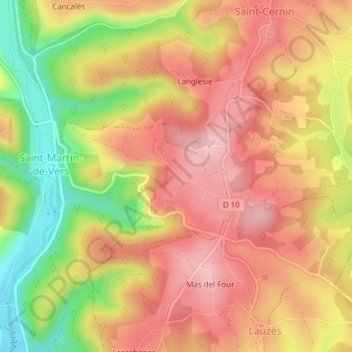
Name: 46360 topographic map, elevation, terrain.
Average elevation: 1,053 ft
Minimum elevation: 669 ft
Maximum elevation: 1,302 ft
Other topographic maps
Click on a map to view its topography, its elevation and its terrain.
Saint-Martin-de-Vers
France > Occitanie > Lot > Les Pechs-du-Vers
Saint-Martin-de-Vers, Les Pechs-du-Vers, Gourdon, Lot, Occitanie, France métropolitaine, 46360, France
Average elevation: 1,053 ft