
Parchal topographic map
Interactive map
Click on the map to display elevation.
About this map
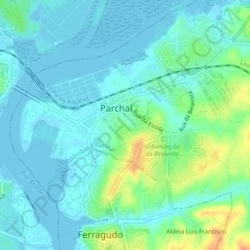
Name: Parchal topographic map, elevation, terrain.
Location: Parchal, Estômbar e Parchal, Lagoa, Faro, Algarve, Portugal (37.12631 -8.53241 37.14503 -8.49782)
Average elevation: 33 ft
Minimum elevation: -10 ft
Maximum elevation: 131 ft
Other topographic maps
Click on a map to view its topography, its elevation and its terrain.
Rio Arade
Portugal > Algarve > Estômbar e Parchal
Rio Arade, Estômbar e Parchal, Lagoa, Faro, Algarve, 8400-112, Portugal
Average elevation: 79 ft
Estômbar e Parchal
Portugal > Algarve > Estômbar e Parchal
Estômbar e Parchal, Lagoa, Faro, Algarve, Portugal
Average elevation: 95 ft