
Rursee topographic map
Interactive map
Click on the map to display elevation.
About this map
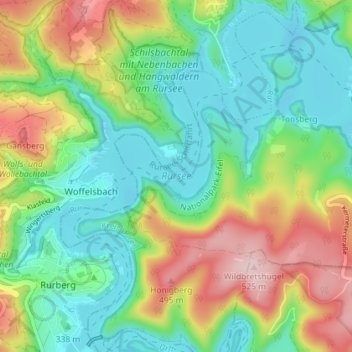
Name: Rursee topographic map, elevation, terrain.
Average elevation: 1,188 ft
Minimum elevation: 902 ft
Maximum elevation: 1,719 ft
Other topographic maps
Click on a map to view its topography, its elevation and its terrain.
Woffelsbach
Duitsland > Noordrijn-Westfalen > Städteregion Aachen > Simmerath > Woffelsbach
Woffelsbach, Simmerath, Städteregion Aachen, Noordrijn-Westfalen, Duitsland
Average elevation: 1,224 ft