
Meije topographic map
Interactive map
Click on the map to display elevation.
About this map
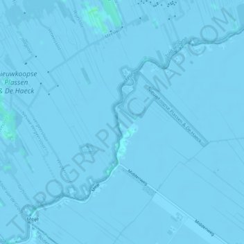
Name: Meije topographic map, elevation, terrain.
Location: Meije, Nieuwkoop, Südholland, Niederlande (52.12255 4.79199 52.14438 4.83188)
Average elevation: -7 ft
Minimum elevation: -13 ft
Maximum elevation: 13 ft